
Exploring Old Town Toronto East through the Urban Palimpsest Method*
I was recently browsing online, looking for some good heritage documentation on Old Town Toronto East (Corktown), one of the richest historical parts of the city. Honestly, I was shocked by how weak the available resources were. The only real document I could find was “Neighbourhood Guides” from the City of Toronto, and it just didn’t tell the full story.
https://www.toronto.ca/wp-content/uploads/2017/11/91c5-Old-Town-Toronto-East-Old-York-Corktown.pdf
I couldn’t stop thinking about how much better it could be, so I decided to take a crack at it myself. With help from my all-time best friend Arash, I re-imagined the area using the Urban Palimpsest Method. My work is based on that "Neighbourhood Guides", but I wanted to dig deeper and show how the layers of history actually stack up. Below is the guideline I put together, remixing that original information into something that actually visualizes the history.
Mapping the Layers
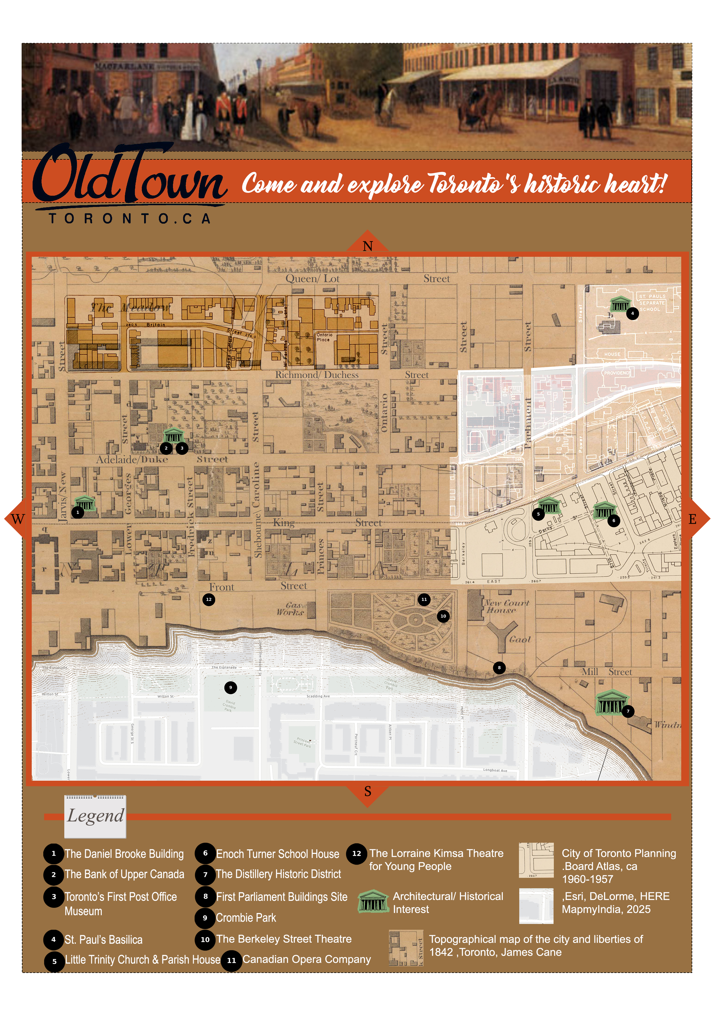
This map isn’t just a snapshot of today; it’s a composite of three different eras. I overlaid the 1842 topographical map and the 1957 Planning Board Atlas onto the modern 2025 street grid. With a heritage map like this, you can navigate using the old names of the streets, like seeing where Duke and Duchess became Adelaide and Richmond, and see how the City has expanded through time. The highlighted zones reveal how the shape of the streets has changed and where historic 'ghosts' intersect with the Toronto we walk through today.
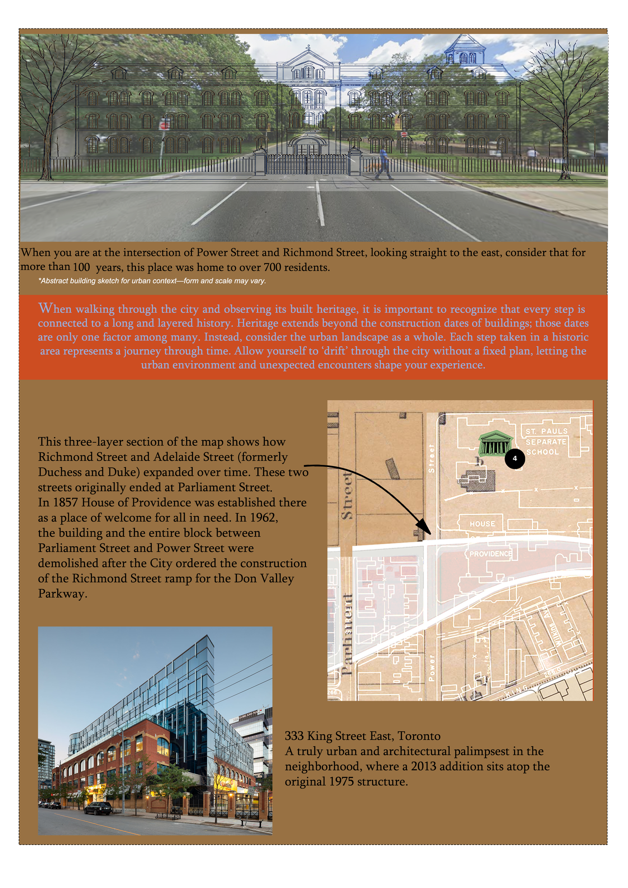
The Lost Block
Here, I wanted to apply the concept of the 'Urban Drift'—exploring without a fixed plan to let the environment reveal itself. You can see how the city’s infrastructure literally erased history here. The House of Providence stood at the end of Richmond and Adelaide (formerly Duchess and Duke) for over a century, welcoming those in need. But in 1962, the entire block was demolished to build the Richmond Street ramp for the Don Valley Parkway. I also highlighted 333 King Street East as a counter-example: a modern 'architectural palimpsest' where a 2013 addition sits right on top of a 1975 structure, showing how we can build with the past instead of just paving over it.
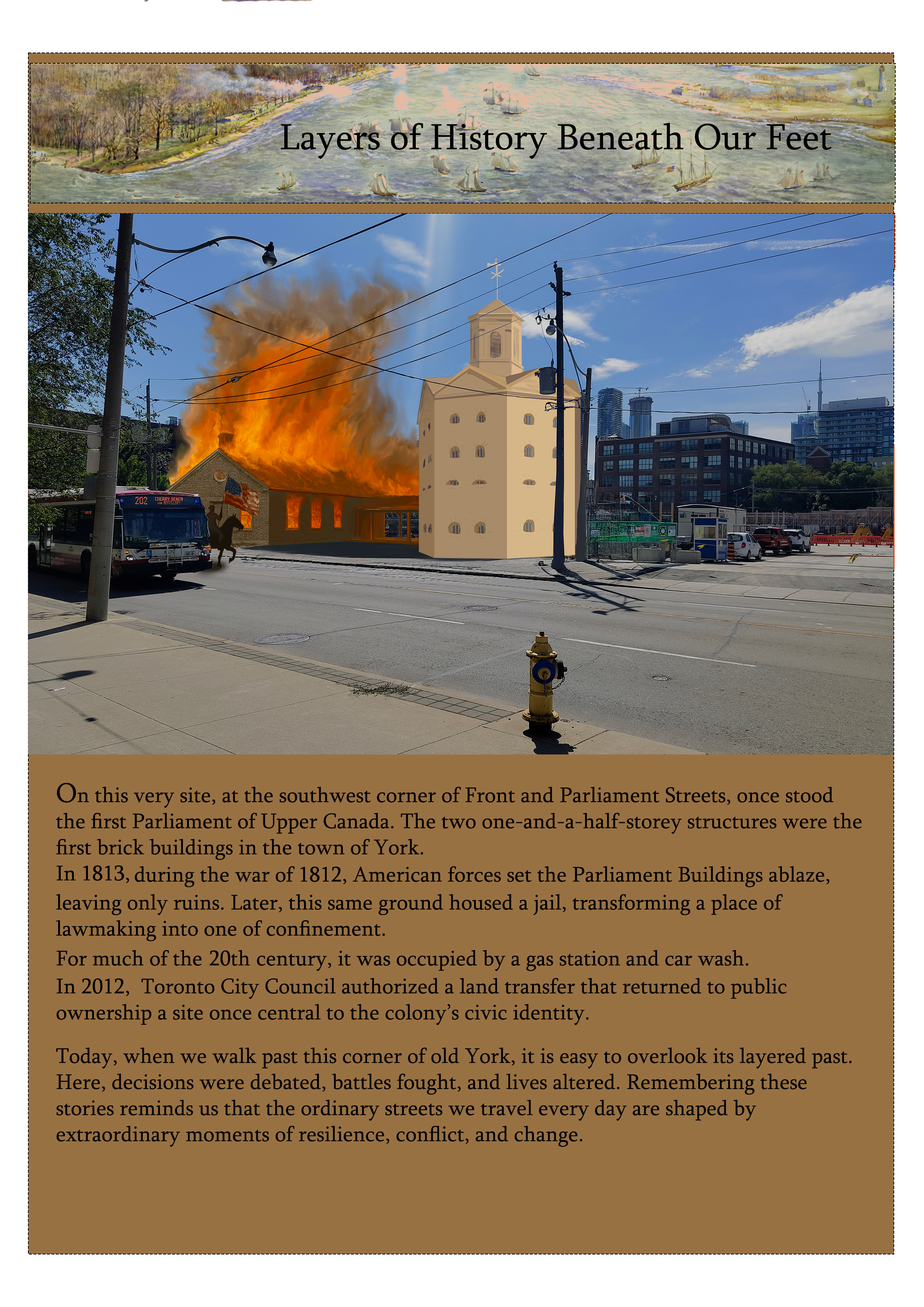
Beneath Our Feet
This site at Front and Parliament is the perfect example of why I love this method. If you walk past it today, you might just see an empty lot or a generic corner, but the layers here are intense. This was the site of the First Parliament of Upper Canada before it was burned down in the War of 1812. It later transformed into a jail, shifting from a place of lawmaking to confinement. But the craziest part? For most of the 20th century, this incredibly significant heritage site was just a gas station and a car wash. It’s a reminder that the ordinary streets we use every day are hiding extraordinary stories.